- Description 簡介
- Questions 問題
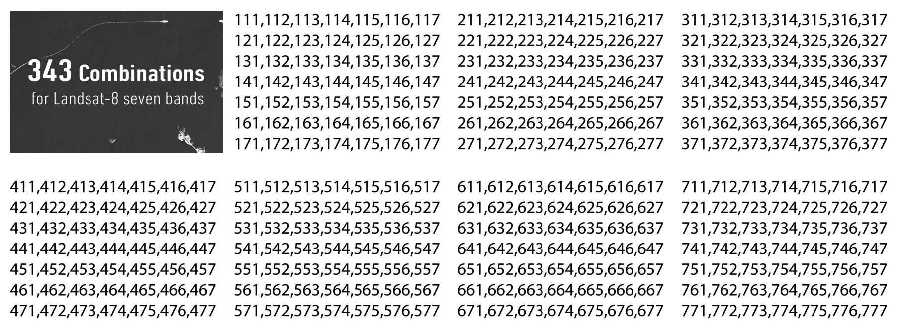
- Combinations 組合
Let's try to find those common band combinations applied to Landsat-8!
試著找出應用於Landsat-8的那些常見波段組合!
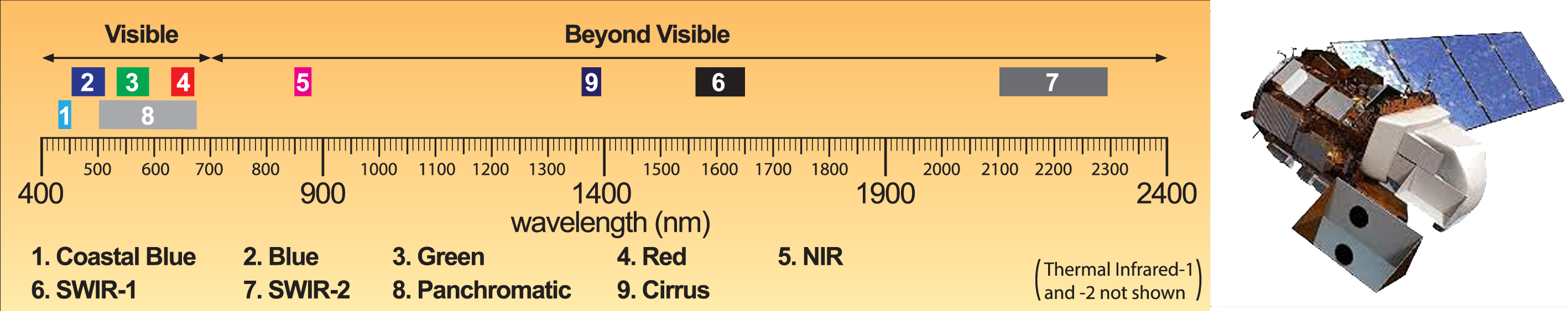
Landsat-8 is the most recent earth observation satellite providing global coverage of the earth at a spatial resolution of 30 meters in visible, NIR, and SWIR bands. Working with multispectral images enables us to reveal information that is beyond human vision. For example, the Near Infrared (NIR) wavelength is commonly used to distinguish vegetation varieties and conditions because vegetation gives a strong reflection in this portion of the electromagnetic spectrum.
Let's try the following band combinations and know more about their application: (4,3,2), (5,4,3), (7,6,4), (5,6,4), (7,5,3), (5,7,1).
You could also try the following combinations to know more about each band and its application. (1,1,1), (2,2,2), (3,3,3), (4,4,4), (5,5,5), (6,6,6), (7,7,7)
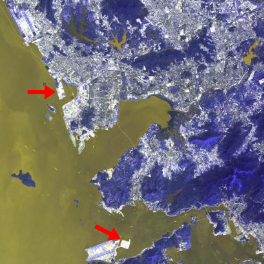
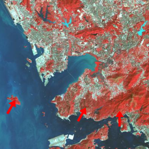
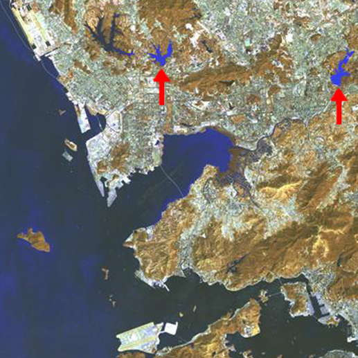
Let's try hover your mouse cursor over the image to zoom into the Pearl River Delta!
Landsat-8是最新的地球觀測衛星,可在可見光、NIR 和 SWIR 波段以30米的空間解像度提供地球的全球覆蓋。多光譜圖像使我們能夠揭示超出人類視覺範圍的信息。例如,近紅外(NIR)波長通常用於區分植被種類和狀況,因為植被在這一波段會產生強烈反射。
嘗試以下的波段組合,來了解更多關於這些波段組合的應用。 (4,3,2), (5,4,3), (7,6,4), (5,6,4), (7,5,3), (5,7,1)
您也可以嘗試以下的波段組合,來了解更多關於每個波段的功能和應用。 (1,1,1), (2,2,2), (3,3,3), (4,4,4), (5,5,5), (6,6,6), (7,7,7)
嘗試將鼠標停在圖像上,以放大珠江三角洲!
Which band combinations show the following more clearly? 哪些波段組合更清楚地顯示了以下內容?
- Reservoir location 水庫位置
- Variation of turbidity in the reservoirs 水庫濁度的變化
- Vegetation distribution 植被分佈
- Built-up area location 房屋密集區位置
Three bands are combined to form an image composite. 三個波段組合形成圖像合成
Different combinations reveal different details. 不同的組合揭示不同的細節。